
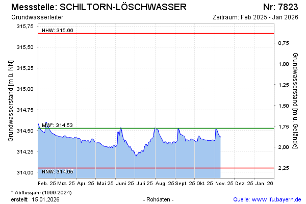
Current data SCHILTORN-LÖSCHWASSER
Groundwater level [m above sealevel]: 314,29
Distance to surface [m]: 2,01
Last value from 02.06.2026 08:48
Ground level [m above sealevel]: 316.30
| Date | Groundwater level [m above sealevel] |
|---|---|
| 26.03.2026 | 314.42 |
| 25.03.2026 | 314.44 |
| 24.03.2026 | 314.44 |
| 23.03.2026 | 314.44 |
| 22.03.2026 | 314.45 |
| 21.03.2026 | 314.46 |
| 20.03.2026 | 314.47 |
| 19.03.2026 | 314.48 |