
- Start >
- Groundwater >
- Waterlevel of upper layer >
- Untere Donau >
- ROTTERSDORF ZA 17 >
- Year chart of precipitation

Year chart of precipitation ROTTERSDORF ZA 17
Groundwater levels of the last 12 months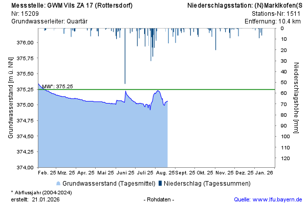
Groundwater level [m above sealevel]: 375,04
Distance to surface [m]: 2,39
Last value from 14.04.2026 09:15
Ground level [m above sealevel]: 377.43
© Bayerisches Landesamt für Umwelt 2026