
- Start >
- Groundwater >
- Waterlevel of upper layer >
- Untere Donau >
- REGENSBURG HAFEN Q5 >
- Chart of total period

Chart of total period REGENSBURG HAFEN Q5
Groundwater levels of the total period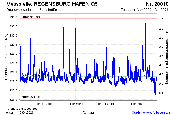
Groundwater level [m above sealevel]: 326.75
Distance to surface [m]: 5.63
Last value from 14.12.2025 10:00
Ground level [m above sealevel]: 332.38
| Date | Groundwater level [m above sealevel] |
|---|---|
| 14.12.2025 | 326.76 |
| 13.12.2025 | 326.75 |
| 12.12.2025 | 326.76 |
| 11.12.2025 | 326.76 |
| 10.12.2025 | 327.38 |
| 09.12.2025 | 327.71 |
| 08.12.2025 | 327.53 |
| 07.12.2025 | 327.52 |
© Bayerisches Landesamt für Umwelt 2025