
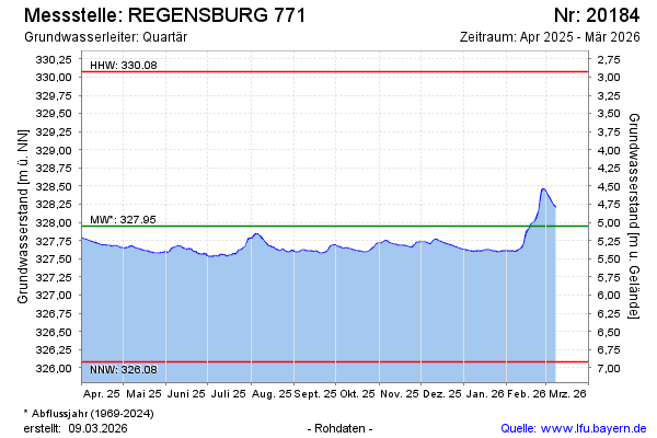
Current data REGENSBURG 771
Groundwater level [m above sealevel]: 327.48
Distance to surface [m]: 5.52
Last value from 14.07.2026 10:00
Ground level [m above sealevel]: 333.00
| Date | Groundwater level [m above sealevel] |
|---|---|
| 14.07.2026 | 327.50 |
| 13.07.2026 | 327.51 |
| 12.07.2026 | 327.51 |
| 11.07.2026 | 327.51 |
| 10.07.2026 | 327.52 |
| 09.07.2026 | 327.52 |
| 08.07.2026 | 327.53 |
| 07.07.2026 | 327.54 |