Year chart of precipitation POIGHAM
note
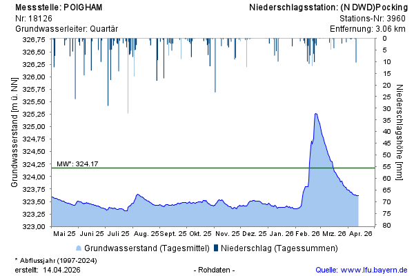
GW Messstelle im Grundnetz
Groundwater level [m above sealevel]: 323,10
Distance to surface [m]: 3,50
Last value from 14.07.2026 03:50
Ground level [m above sealevel]: 326.60

GW Messstelle im Grundnetz
Groundwater level [m above sealevel]: 323,10
Distance to surface [m]: 3,50
Last value from 14.07.2026 03:50
Ground level [m above sealevel]: 326.60