
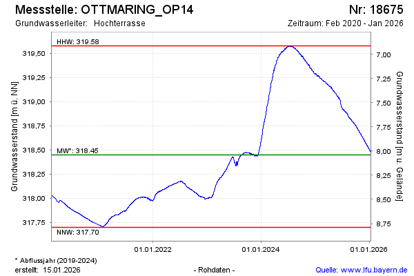
Chart of total period OTTMARING_OP14
Groundwater level [m above sealevel]: 318,09
Distance to surface [m]: 8,40
Last value from 22.07.2026 08:00
Ground level [m above sealevel]: 326.49
| Date | Groundwater level [m above sealevel] |
|---|---|
| 22.07.2026 | 318.09 |
| 21.07.2026 | 318.09 |
| 20.07.2026 | 318.09 |
| 19.07.2026 | 318.10 |
| 18.07.2026 | 318.10 |
| 17.07.2026 | 318.10 |
| 16.07.2026 | 318.11 |
| 15.07.2026 | 318.11 |