
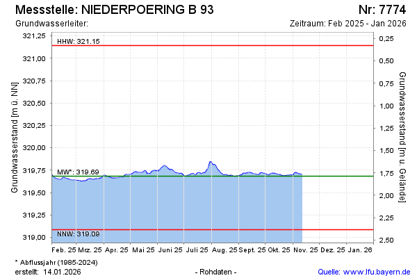
Current data NIEDERPOERING B 93
Groundwater level [m above sealevel]: 319.72
Distance to surface [m]: 1.75
Last value from 25.06.2026 13:10
Ground level [m above sealevel]: 321.47
| Date | Groundwater level [m above sealevel] |
|---|---|
| 13.03.2026 | 319.72 |
| 12.03.2026 | 319.72 |
| 11.03.2026 | 319.72 |
| 10.03.2026 | 319.72 |
| 09.03.2026 | 319.73 |
| 08.03.2026 | 319.73 |
| 07.03.2026 | 319.74 |
| 06.03.2026 | 319.75 |