
- Start >
- Groundwater >
- Waterlevel of upper layer >
- Untere Donau >
- Niederalteich (Q7) >
- Year chart of precipitation

Year chart of precipitation Niederalteich (Q7)
Groundwater levels of the last 12 months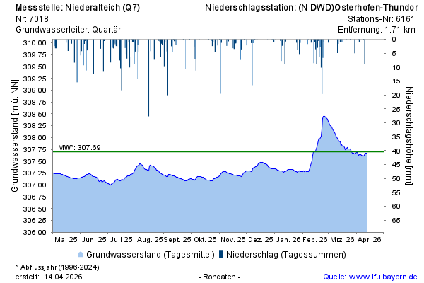
note
Derzeit Umbau der Datenfernübertragung
Groundwater level [m above sealevel]: 307,67
Distance to surface [m]: 2,03
Last value from 12.04.2026 08:00
Ground level [m above sealevel]: 309.70
© Bayerisches Landesamt für Umwelt 2026