
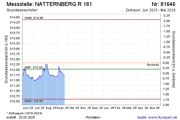
Current data NATTERNBERG R 181
Groundwater level [m above sealevel]: 311.70
Distance to surface [m]: 0.63
Last value from 21.09.2025 12:00
Ground level [m above sealevel]: 312.33
| Date | Groundwater level [m above sealevel] |
|---|---|
| 31.12.2024 | 312.29 |
| 30.12.2024 | 312.30 |
| 29.12.2024 | 312.31 |
| 28.12.2024 | 312.33 |
| 27.12.2024 | 312.34 |
| 26.12.2024 | 312.35 |
| 25.12.2024 | 312.37 |
| 24.12.2024 | 312.39 |