
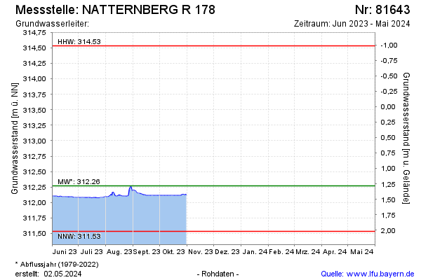
Current data NATTERNBERG R 178
Groundwater level [m above sealevel]: 312.29
Distance to surface [m]: 1.26
Last value from 31.10.2025 18:00
Ground level [m above sealevel]: 313.55
| Date | Groundwater level [m above sealevel] |
|---|---|
| 31.12.2024 | 312.39 |
| 30.12.2024 | 312.40 |
| 29.12.2024 | 312.41 |
| 28.12.2024 | 312.42 |
| 27.12.2024 | 312.44 |
| 26.12.2024 | 312.45 |
| 25.12.2024 | 312.47 |
| 24.12.2024 | 312.49 |