
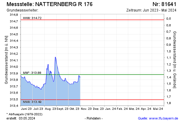
Current data NATTERNBERG R 176
Groundwater level [m above sealevel]: 313.90
Distance to surface [m]: 1.34
Last value from 31.10.2025 18:00
Ground level [m above sealevel]: 315.24
| Date | Groundwater level [m above sealevel] |
|---|---|
| 31.12.2024 | 314.04 |
| 30.12.2024 | 314.04 |
| 29.12.2024 | 314.06 |
| 28.12.2024 | 314.07 |
| 27.12.2024 | 314.08 |
| 26.12.2024 | 314.09 |
| 25.12.2024 | 314.11 |
| 24.12.2024 | 314.13 |