
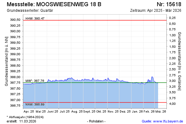
Current data MOOSWIESENWEG 18 B
Groundwater level [m above sealevel]: 387.73
Distance to surface [m]: 3.1
Last value from 14.07.2026 10:00
Ground level [m above sealevel]: 390.83
| Date | Groundwater level [m above sealevel] |
|---|---|
| 14.07.2026 | 387.73 |
| 13.07.2026 | 387.73 |
| 12.07.2026 | 387.73 |
| 11.07.2026 | 387.74 |
| 10.07.2026 | 387.74 |
| 09.07.2026 | 387.74 |
| 08.07.2026 | 387.74 |
| 07.07.2026 | 387.75 |