
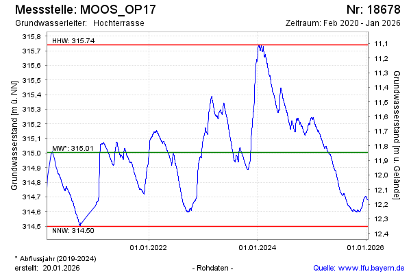
Chart of total period MOOS_OP17
Groundwater level [m above sealevel]: 314,52
Distance to surface [m]: 12,33
Last value from 23.07.2026 08:00
Ground level [m above sealevel]: 326.85
| Date | Groundwater level [m above sealevel] |
|---|---|
| 23.07.2026 | 314.52 |
| 22.07.2026 | 314.52 |
| 21.07.2026 | 314.53 |
| 20.07.2026 | 314.53 |
| 19.07.2026 | 314.54 |
| 18.07.2026 | 314.54 |
| 17.07.2026 | 314.55 |
| 16.07.2026 | 314.55 |