
- Start >
- Groundwater >
- Waterlevel of upper layer >
- Untere Donau >
- MITTERWÖHR KL.ISAR 70/59 >
- Year chart of precipitation

Year chart of precipitation MITTERWÖHR KL.ISAR 70/59
Groundwater levels of the last 12 months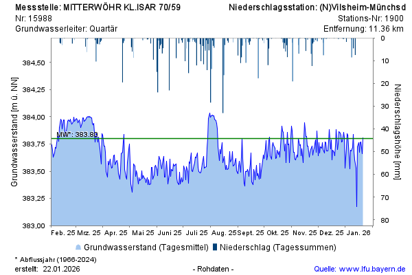
Groundwater level [m above sealevel]: 383,55
Distance to surface [m]: 2,20
Last value from 20.05.2026 10:00
Ground level [m above sealevel]: 385.75
© Bayerisches Landesamt für Umwelt 2026