
Current data Mallersdorf Q6
note
GW Messstelle im Grundnetz
Groundwater level [m above sealevel]: 378.72
Distance to surface [m]: 2.8699999999999
Last value from 24.06.2026 08:00
Ground level [m above sealevel]: 381.59
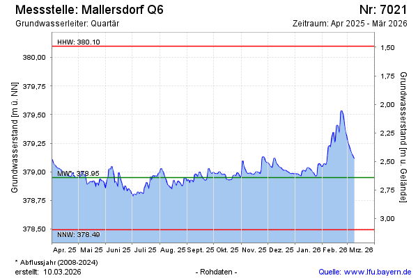
| Date | Groundwater level [m above sealevel] |
|---|---|
| 29.06.2026 | 378.69 |
| 28.06.2026 | 378.67 |
| 27.06.2026 | 378.66 |
| 26.06.2026 | 378.68 |
| 25.06.2026 | 378.69 |
| 24.06.2026 | 378.69 |
| 23.06.2026 | 378.71 |
| 22.06.2026 | 378.72 |