
- Start >
- Groundwater >
- Waterlevel of upper layer >
- Untere Donau >
- LINDENSCHLAG 710 >
- Chart of total period

Chart of total period LINDENSCHLAG 710
Groundwater levels of the total period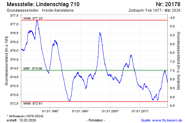
Groundwater level [m above sealevel]: 373.74
Distance to surface [m]: 8.14
Last value from 16.01.2026 09:24
Ground level [m above sealevel]: 381.88
| Date | Groundwater level [m above sealevel] |
|---|---|
| 16.01.2026 | 373.75 |
| 15.01.2026 | 373.75 |
| 14.01.2026 | 373.75 |
| 13.01.2026 | 373.76 |
| 12.01.2026 | 373.76 |
| 11.01.2026 | 373.74 |
| 10.01.2026 | 373.76 |
| 09.01.2026 | 373.79 |
© Bayerisches Landesamt für Umwelt 2026