
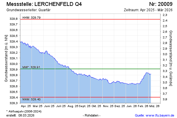
Current data LERCHENFELD Q4
Groundwater level [m above sealevel]: 328.56
Distance to surface [m]: 3.61
Last value from 24.06.2026 10:00
Ground level [m above sealevel]: 332.17
| Date | Groundwater level [m above sealevel] |
|---|---|
| 27.06.2026 | 328.54 |
| 26.06.2026 | 328.54 |
| 25.06.2026 | 328.55 |
| 24.06.2026 | 328.56 |
| 23.06.2026 | 328.57 |
| 22.06.2026 | 328.58 |
| 21.06.2026 | 328.59 |
| 20.06.2026 | 328.59 |