
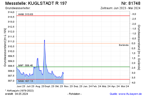
Current data KUGLSTADT R 197
Groundwater level [m above sealevel]: 308.38
Distance to surface [m]: 2.42
Last value from 31.10.2025 21:00
Ground level [m above sealevel]: 310.80
| Date | Groundwater level [m above sealevel] |
|---|---|
| 31.12.2024 | 308.33 |
| 30.12.2024 | 308.40 |
| 29.12.2024 | 308.45 |
| 28.12.2024 | 308.51 |
| 27.12.2024 | 308.60 |
| 26.12.2024 | 308.81 |
| 25.12.2024 | 308.96 |
| 24.12.2024 | 308.97 |