
- Start >
- Groundwater >
- Waterlevel of upper layer >
- Untere Donau >
- KAISERBURG NUERNBERG >
- Current data

Current data KAISERBURG NUERNBERG
Groundwater levels of the last 12 months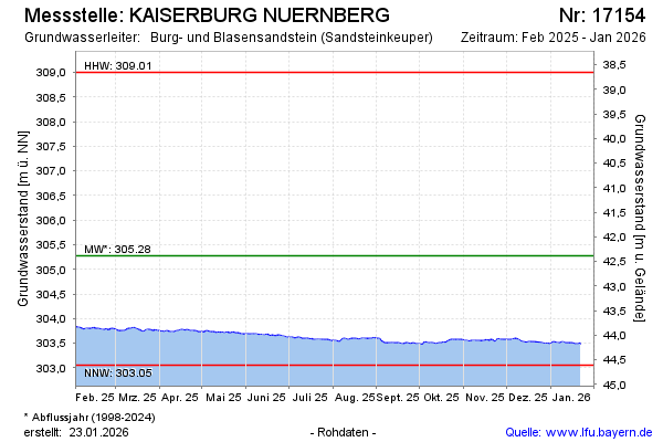
Groundwater level [m above sealevel]: 303.54
Distance to surface [m]: 44.12
Last value from 26.05.2026 10:00
Ground level [m above sealevel]: 347.66
| Date | Groundwater level [m above sealevel] |
|---|---|
| 26.05.2026 | 303.54 |
| 25.05.2026 | 303.54 |
| 24.05.2026 | 303.55 |
| 23.05.2026 | 303.55 |
| 22.05.2026 | 303.56 |
| 21.05.2026 | 303.57 |
| 20.05.2026 | 303.58 |
| 19.05.2026 | 303.59 |
© Bayerisches Landesamt für Umwelt 2026