
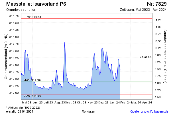
Current data Isarvorland P6
note
GW Messstelle im SN Isarvorland
Groundwater level [m above sealevel]: 312.12
Distance to surface [m]: 1.23
Last value from 26.06.2026 15:30
Ground level [m above sealevel]: 313.35
| Date | Groundwater level [m above sealevel] |
|---|---|
| 02.04.2026 | 312.20 |
| 01.04.2026 | 312.20 |
| 31.03.2026 | 312.20 |
| 30.03.2026 | 312.19 |
| 29.03.2026 | 312.20 |
| 28.03.2026 | 312.20 |
| 27.03.2026 | 312.19 |
| 26.03.2026 | 312.19 |