
Current data Isarvorland P3
note
GW Messstelle im SN Isarvorland
Groundwater level [m above sealevel]: 310.67
Distance to surface [m]: 1.37
Last value from 02.06.2026 14:13
Ground level [m above sealevel]: 312.04
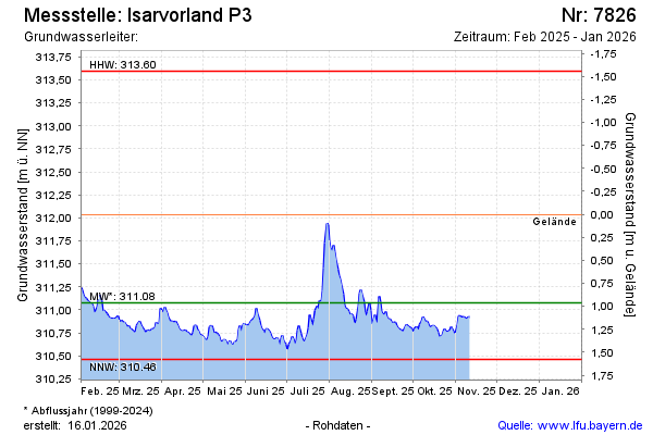
| Date | Groundwater level [m above sealevel] |
|---|---|
| 02.06.2026 | 310.65 |
| 01.06.2026 | 310.60 |
| 31.05.2026 | 310.57 |
| 30.05.2026 | 310.57 |
| 29.05.2026 | 310.57 |
| 28.05.2026 | 310.57 |
| 27.05.2026 | 310.57 |
| 26.05.2026 | 310.58 |