
- Start >
- Groundwater >
- Waterlevel of upper layer >
- Untere Donau >
- ISAR KM 1.6 B 77 >
- Chart of total period

Chart of total period ISAR KM 1.6 B 77
Groundwater levels of the total period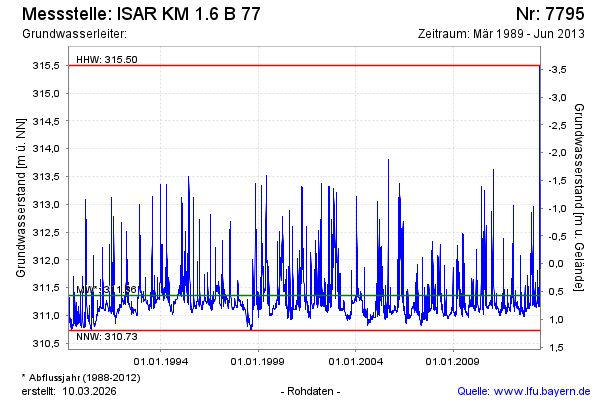
note
GW Messstelle im SKS Pielweichs
Groundwater level [m above sealevel]: 311.97
Distance to surface [m]: -0.04
Last value from 27.06.2013 00:00
Ground level [m above sealevel]: 311.93
| Date | Groundwater level [m above sealevel] |
|---|---|
| 26.06.2013 | 311.95 |
| 25.06.2013 | 311.89 |
| 24.06.2013 | 311.85 |
| 23.06.2013 | 311.93 |
| 22.06.2013 | 312.03 |
| 21.06.2013 | 312.03 |
| 20.06.2013 | 312.10 |
| 19.06.2013 | 312.18 |
© Bayerisches Landesamt für Umwelt 2026