
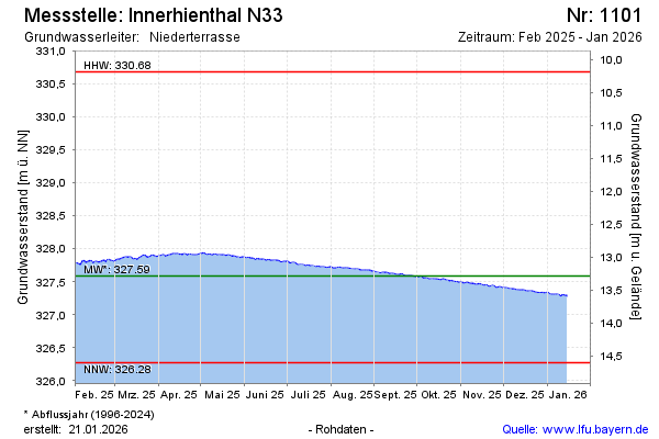
Current data Innerhienthal N33
Groundwater level [m above sealevel]: 326.87
Distance to surface [m]: 14
Last value from 24.06.2026 08:00
Ground level [m above sealevel]: 340.87
| Date | Groundwater level [m above sealevel] |
|---|---|
| 27.06.2026 | 326.86 |
| 26.06.2026 | 326.87 |
| 25.06.2026 | 326.87 |
| 24.06.2026 | 326.87 |
| 23.06.2026 | 326.88 |
| 22.06.2026 | 326.88 |
| 21.06.2026 | 326.88 |
| 20.06.2026 | 326.88 |