
- Start >
- Groundwater >
- Waterlevel of upper layer >
- Untere Donau >
- GARCHING 2 >
- Chart of total period

Chart of total period GARCHING 2
Groundwater levels of the total period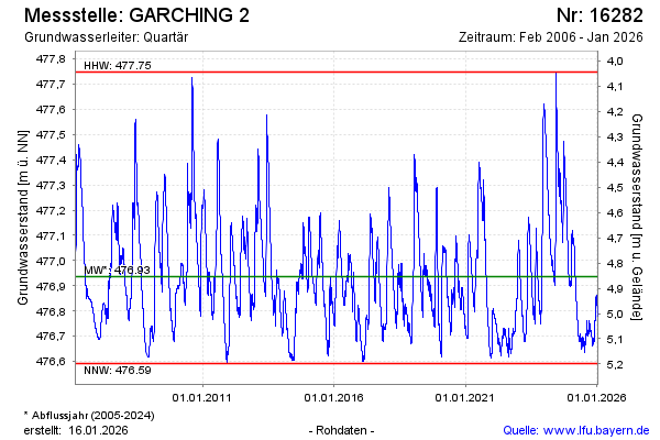
Groundwater level [m above sealevel]: 476.97
Distance to surface [m]: 4.82
Last value from 27.04.2024 10:00
Ground level [m above sealevel]: 481.79
| Date | Groundwater level [m above sealevel] |
|---|---|
| 26.04.2024 | 476.98 |
| 25.04.2024 | 476.98 |
| 24.04.2024 | 476.99 |
| 23.04.2024 | 476.99 |
| 22.04.2024 | 477.00 |
| 21.04.2024 | 476.99 |
| 20.04.2024 | 476.99 |
| 19.04.2024 | 476.99 |
© Bayerisches Landesamt für Umwelt 2024