
- Start >
- Groundwater >
- Waterlevel of upper layer >
- Untere Donau >
- Gangkofen B 7 >
- Chart of total period

Chart of total period Gangkofen B 7
Groundwater levels of the total period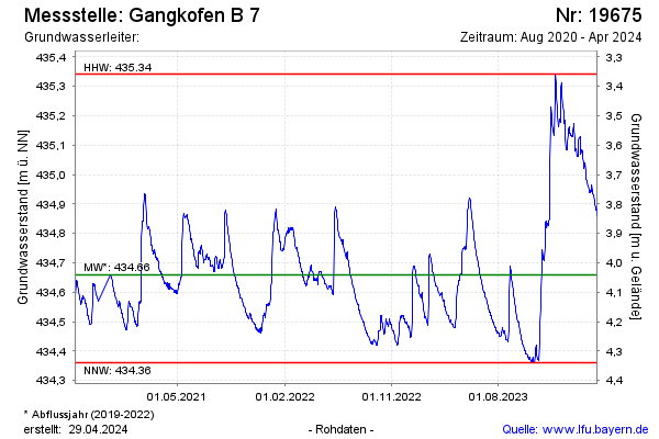
Groundwater level [m above sealevel]: 434.73
Distance to surface [m]: 3.97
Last value from 19.08.2025 09:46
Ground level [m above sealevel]: 438.70
| Date | Groundwater level [m above sealevel] |
|---|---|
| 19.08.2025 | 434.73 |
| 18.08.2025 | 434.74 |
| 17.08.2025 | 434.75 |
| 16.08.2025 | 434.75 |
| 15.08.2025 | 434.76 |
| 14.08.2025 | 434.77 |
| 13.08.2025 | 434.79 |
| 12.08.2025 | 434.80 |
© Bayerisches Landesamt für Umwelt 2026