
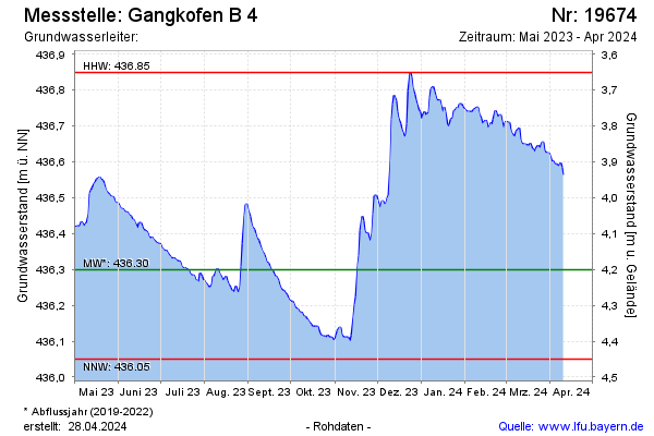
Current data Gangkofen B 4
Groundwater level [m above sealevel]: 435,97
Distance to surface [m]: 4,53
Last value from 15.06.2026 09:48
Ground level [m above sealevel]: 440.50
| Date | Groundwater level [m above sealevel] |
|---|---|
| 15.06.2026 | 435.97 |
| 14.06.2026 | 435.97 |
| 13.06.2026 | 435.97 |
| 12.06.2026 | 435.97 |
| 11.06.2026 | 435.97 |
| 10.06.2026 | 435.94 |
| 09.06.2026 | 435.92 |
| 08.06.2026 | 435.92 |