
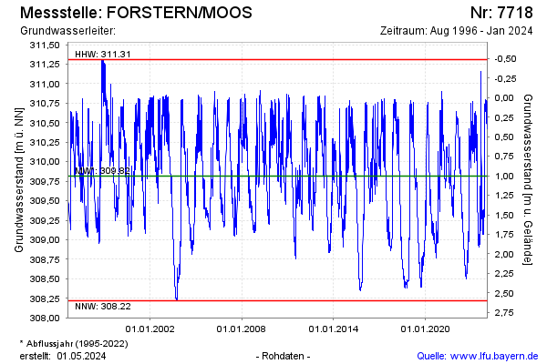
Chart of total period FORSTERN/MOOS
note
GW Messstelle im SN SKS Pielweichs
Groundwater level [m above sealevel]: 308,89
Distance to surface [m]: 1,93
Last value from 02.06.2026 14:54
Ground level [m above sealevel]: 310.82
| Date | Groundwater level [m above sealevel] |
|---|---|
| 02.06.2026 | 308.89 |
| 01.06.2026 | 308.90 |
| 31.05.2026 | 308.91 |
| 30.05.2026 | 308.93 |
| 29.05.2026 | 308.95 |
| 28.05.2026 | 308.97 |
| 27.05.2026 | 308.99 |
| 26.05.2026 | 309.01 |