
- Start >
- Groundwater >
- Waterlevel of upper layer >
- Untere Donau >
- Flussraummanagement Vils ZA 15 >
- Current data

Current data Flussraummanagement Vils ZA 15
Groundwater levels of the last 12 months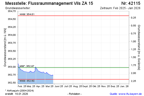
Groundwater level [m above sealevel]: 352.78
Distance to surface [m]: 2.02
Last value from 20.04.2026 08:15
Ground level [m above sealevel]: 354.80
| Date | Groundwater level [m above sealevel] |
|---|---|
| 20.04.2026 | 352.77 |
| 19.04.2026 | 352.77 |
| 18.04.2026 | 352.77 |
| 17.04.2026 | 352.77 |
| 16.04.2026 | 352.78 |
| 15.04.2026 | 352.78 |
| 14.04.2026 | 352.79 |
| 13.04.2026 | 352.81 |
© Bayerisches Landesamt für Umwelt 2026