
- Start >
- Groundwater >
- Waterlevel of upper layer >
- Untere Donau >
- Flussraummanagement Vils ZA 14 >
- Year chart of precipitation

Year chart of precipitation Flussraummanagement Vils ZA 14
Groundwater levels of the last 12 months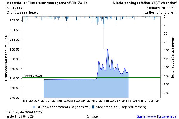
Groundwater level [m above sealevel]: 348,89
Distance to surface [m]: 2,53
Last value from 22.12.2025 09:30
Ground level [m above sealevel]: 351.42
© Bayerisches Landesamt für Umwelt 2026