
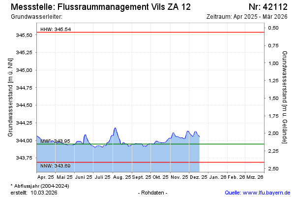
Current data Flussraummanagement Vils ZA 12
Groundwater level [m above sealevel]: 343,98
Distance to surface [m]: 2,12
Last value from 20.04.2026 00:00
Ground level [m above sealevel]: 346.10
| Date | Groundwater level [m above sealevel] |
|---|---|
| 19.04.2026 | 343.99 |
| 18.04.2026 | 343.99 |
| 17.04.2026 | 343.99 |
| 16.04.2026 | 343.99 |
| 15.04.2026 | 344.00 |
| 14.04.2026 | 344.00 |
| 13.04.2026 | 344.01 |
| 12.04.2026 | 344.00 |