
- Start >
- Groundwater >
- Waterlevel of upper layer >
- Untere Donau >
- Flussraummanagement Vils ZA 11 >
- Year chart of precipitation

Year chart of precipitation Flussraummanagement Vils ZA 11
Groundwater levels of the last 12 months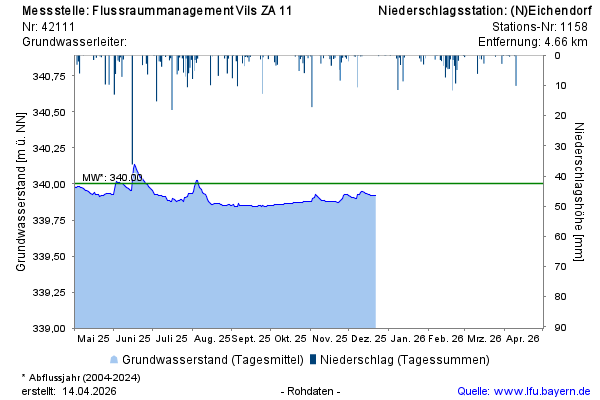
Groundwater level [m above sealevel]: 339,93
Distance to surface [m]: 2,15
Last value from 22.12.2025 10:05
Ground level [m above sealevel]: 342.08
© Bayerisches Landesamt für Umwelt 2026