
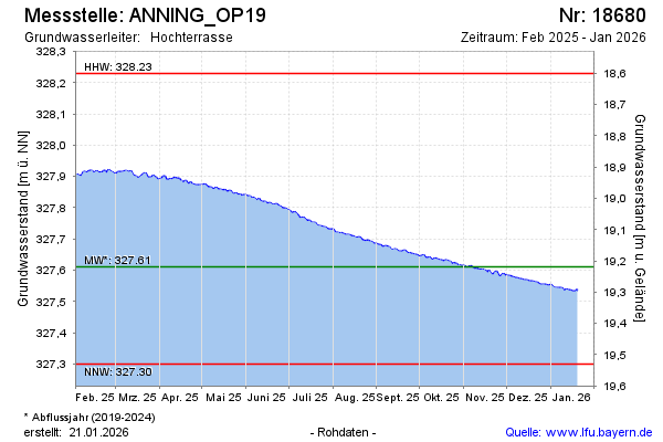
Current data ANNING_OP19
Groundwater level [m above sealevel]: 327.47
Distance to surface [m]: 19.36
Last value from 24.06.2026 08:00
Ground level [m above sealevel]: 346.83
| Date | Groundwater level [m above sealevel] |
|---|---|
| 28.06.2026 | 327.46 |
| 27.06.2026 | 327.46 |
| 26.06.2026 | 327.46 |
| 25.06.2026 | 327.46 |
| 24.06.2026 | 327.47 |
| 23.06.2026 | 327.47 |
| 22.06.2026 | 327.47 |
| 21.06.2026 | 327.47 |