
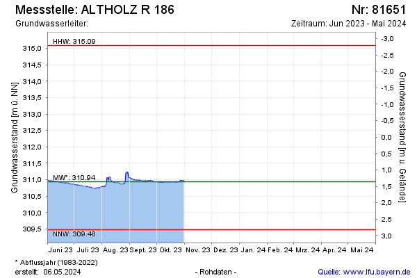
Current data ALTHOLZ R 186
Groundwater level [m above sealevel]: 310.97
Distance to surface [m]: 1.33
Last value from 31.10.2025 18:00
Ground level [m above sealevel]: 312.30
| Date | Groundwater level [m above sealevel] |
|---|---|
| 31.12.2024 | 311.11 |
| 30.12.2024 | 311.12 |
| 29.12.2024 | 311.14 |
| 28.12.2024 | 311.15 |
| 27.12.2024 | 311.17 |
| 26.12.2024 | 311.18 |
| 25.12.2024 | 311.21 |
| 24.12.2024 | 311.28 |