
Current data WEIHERAECKER A 996
Groundwater level [m above sealevel]: 442.66
Distance to surface [m]: 45.58
Last value from 13.07.2026 10:00
Ground level [m above sealevel]: 488.24
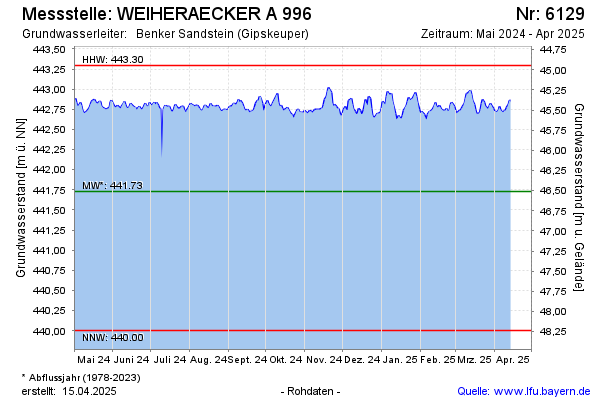
| Date | Groundwater level [m above sealevel] |
|---|---|
| 13.07.2026 | 442.68 |
| 12.07.2026 | 442.68 |
| 11.07.2026 | 442.70 |
| 10.07.2026 | 442.72 |
| 09.07.2026 | 442.72 |
| 08.07.2026 | 442.74 |
| 07.07.2026 | 442.73 |
| 06.07.2026 | 442.70 |