
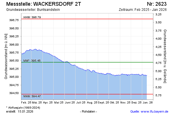
Current data WACKERSDORF 2T
Groundwater level [m above sealevel]: 394.79
Distance to surface [m]: 5.39
Last value from 14.07.2026 04:00
Ground level [m above sealevel]: 400.18
| Date | Groundwater level [m above sealevel] |
|---|---|
| 12.07.2026 | 394.80 |
| 11.07.2026 | 394.81 |
| 10.07.2026 | 394.82 |
| 09.07.2026 | 394.83 |
| 08.07.2026 | 394.84 |
| 07.07.2026 | 394.85 |
| 06.07.2026 | 394.85 |
| 05.07.2026 | 394.86 |