
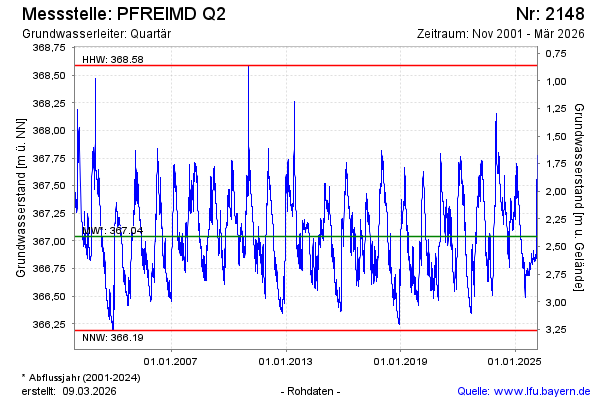
Chart of total period Pfreimd
Groundwater level [m above sealevel]: 366,53
Distance to surface [m]: 2,92
Last value from 23.07.2026 04:00
Ground level [m above sealevel]: 369.45
| Date | Groundwater level [m above sealevel] |
|---|---|
| 22.07.2026 | 366.54 |
| 21.07.2026 | 366.54 |
| 20.07.2026 | 366.55 |
| 19.07.2026 | 366.55 |
| 18.07.2026 | 366.56 |
| 17.07.2026 | 366.56 |
| 16.07.2026 | 366.57 |
| 15.07.2026 | 366.58 |