
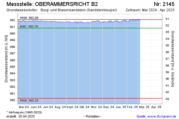
Current data OBERAMMERSRICHT B2
Groundwater level [m above sealevel]: 391.43
Distance to surface [m]: 31.77
Last value from 23.06.2026 04:00
Ground level [m above sealevel]: 423.20
| Date | Groundwater level [m above sealevel] |
|---|---|
| 29.06.2026 | 391.42 |
| 28.06.2026 | 391.42 |
| 27.06.2026 | 391.42 |
| 26.06.2026 | 391.43 |
| 25.06.2026 | 391.44 |
| 24.06.2026 | 391.45 |
| 23.06.2026 | 391.44 |
| 22.06.2026 | 391.41 |