
- Start >
- Groundwater >
- Waterlevel of upper layer >
- Naab - Regen >
- Neunaigen >
- Chart of total period

Chart of total period Neunaigen
Groundwater levels of the total period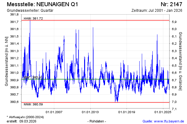
Groundwater level [m above sealevel]: 380.77
Distance to surface [m]: 6.83
Last value from 20.01.2026 10:30
Ground level [m above sealevel]: 387.60
| Date | Groundwater level [m above sealevel] |
|---|---|
| 20.01.2026 | 380.78 |
| 19.01.2026 | 380.79 |
| 18.01.2026 | 380.79 |
| 17.01.2026 | 380.81 |
| 16.01.2026 | 380.83 |
| 15.01.2026 | 380.82 |
| 14.01.2026 | 380.81 |
| 13.01.2026 | 380.78 |
© Bayerisches Landesamt für Umwelt 2026