
- Start >
- Groundwater >
- Waterlevel of upper layer >
- Naab - Regen >
- Münchshöf >
- Current data

Current data Münchshöf
Groundwater levels of the last 12 months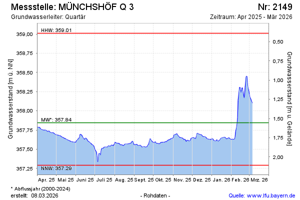
Groundwater level [m above sealevel]: 357.59
Distance to surface [m]: 1.81
Last value from 27.05.2026 04:00
Ground level [m above sealevel]: 359.40
| Date | Groundwater level [m above sealevel] |
|---|---|
| 27.05.2026 | 357.59 |
| 26.05.2026 | 357.59 |
| 25.05.2026 | 357.59 |
| 24.05.2026 | 357.60 |
| 23.05.2026 | 357.61 |
| 22.05.2026 | 357.62 |
| 21.05.2026 | 357.62 |
| 20.05.2026 | 357.62 |
© Bayerisches Landesamt für Umwelt 2026