
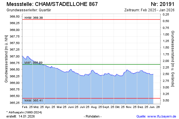
Current data CHAM/STADELLOHE 867
Groundwater level [m above sealevel]: 366.27
Distance to surface [m]: 2.56
Last value from 01.07.2026 10:00
Ground level [m above sealevel]: 368.83
| Date | Groundwater level [m above sealevel] |
|---|---|
| 01.07.2026 | 366.26 |
| 30.06.2026 | 366.24 |
| 29.06.2026 | 366.24 |
| 28.06.2026 | 366.25 |
| 27.06.2026 | 366.26 |
| 26.06.2026 | 366.27 |
| 25.06.2026 | 366.28 |
| 24.06.2026 | 366.29 |