
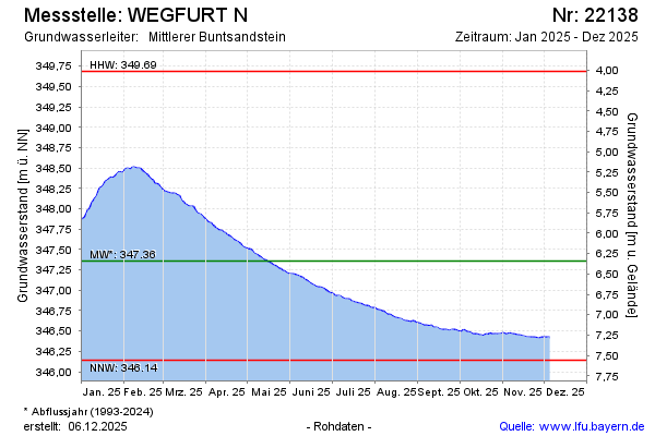
Current data Wegfurt N
Groundwater level [m above sealevel]: 346.49
Distance to surface [m]: 7.23
Last value from 07.07.2026 10:00
Ground level [m above sealevel]: 353.72
| Date | Groundwater level [m above sealevel] |
|---|---|
| 07.07.2026 | 346.50 |
| 06.07.2026 | 346.50 |
| 05.07.2026 | 346.50 |
| 04.07.2026 | 346.51 |
| 03.07.2026 | 346.51 |
| 02.07.2026 | 346.52 |
| 01.07.2026 | 346.55 |
| 30.06.2026 | 346.56 |