
Current data Wegfurt H
Groundwater level [m above sealevel]: 354.88
Distance to surface [m]: 13.54
Last value from 13.07.2026 10:00
Ground level [m above sealevel]: 368.42
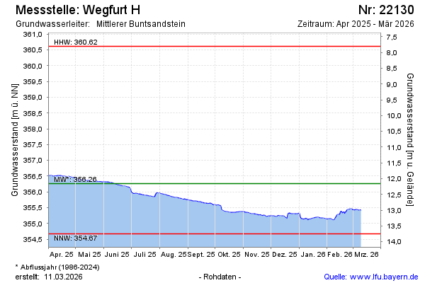
| Date | Groundwater level [m above sealevel] |
|---|---|
| 12.07.2026 | 354.90 |
| 11.07.2026 | 354.91 |
| 10.07.2026 | 354.92 |
| 09.07.2026 | 354.93 |
| 08.07.2026 | 354.93 |
| 07.07.2026 | 354.95 |
| 06.07.2026 | 354.96 |
| 05.07.2026 | 354.96 |