
- Start >
- Groundwater >
- Waterlevel of upper layer >
- Unterer Main >
- Uffenheim-Hinterpfeinach >
- Chart of total period

Chart of total period Uffenheim-Hinterpfeinach
Groundwater levels of the total period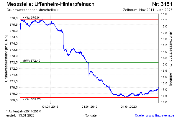
Groundwater level [m above sealevel]: 370.59
Distance to surface [m]: 16.75
Last value from 04.05.2026 13:00
Ground level [m above sealevel]: 387.34
| Date | Groundwater level [m above sealevel] |
|---|---|
| 04.05.2026 | 370.59 |
| 03.05.2026 | 370.59 |
| 02.05.2026 | 370.58 |
| 01.05.2026 | 370.56 |
| 30.04.2026 | 370.55 |
| 29.04.2026 | 370.56 |
| 28.04.2026 | 370.58 |
| 27.04.2026 | 370.57 |
© Bayerisches Landesamt für Umwelt 2026