
Chart of total period Stetten S1
Groundwater level [m above sealevel]: 392,92
Distance to surface [m]: 17,46
Last value from 22.07.2026 10:00
Ground level [m above sealevel]: 410.38
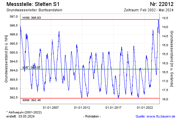
| Date | Groundwater level [m above sealevel] |
|---|---|
| 22.07.2026 | 392.92 |
| 21.07.2026 | 392.92 |
| 20.07.2026 | 392.94 |
| 19.07.2026 | 392.96 |
| 18.07.2026 | 392.98 |
| 17.07.2026 | 393.00 |
| 16.07.2026 | 392.98 |
| 15.07.2026 | 392.99 |