
- Start >
- Groundwater >
- Waterlevel of upper layer >
- Unterer Main >
- STEGAURACH 236 >
- Chart of total period

Chart of total period STEGAURACH 236
Groundwater levels of the total period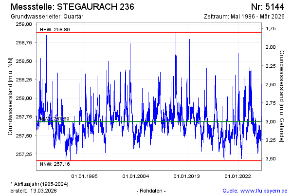
Groundwater level [m above sealevel]: 258.01
Distance to surface [m]: 2.68
Last value from 26.04.2024 09:29
Ground level [m above sealevel]: 260.69
| Date | Groundwater level [m above sealevel] |
|---|---|
| 26.04.2024 | 258.01 |
| 25.04.2024 | 258.04 |
| 24.04.2024 | 258.14 |
| 23.04.2024 | 258.21 |
| 22.04.2024 | 258.08 |
| 21.04.2024 | 258.00 |
| 20.04.2024 | 257.94 |
| 19.04.2024 | 257.92 |
© Bayerisches Landesamt für Umwelt 2024