
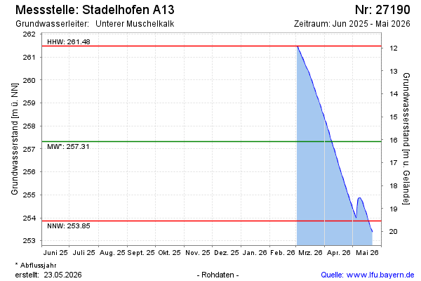
Current data Stadelhofen A13
Groundwater level [m above sealevel]: 248.99
Distance to surface [m]: 24.41
Last value from 14.07.2026 09:00
Ground level [m above sealevel]: 273.40
| Date | Groundwater level [m above sealevel] |
|---|---|
| 14.07.2026 | 249.00 |
| 13.07.2026 | 249.05 |
| 12.07.2026 | 249.11 |
| 11.07.2026 | 249.18 |
| 10.07.2026 | 249.24 |
| 09.07.2026 | 249.31 |
| 08.07.2026 | 249.39 |
| 07.07.2026 | 249.46 |