
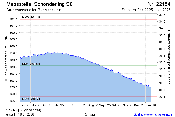
Current data Schönderling S6
Groundwater level [m above sealevel]: 356.19
Distance to surface [m]: 39.12
Last value from 01.07.2026 10:00
Ground level [m above sealevel]: 395.31
| Date | Groundwater level [m above sealevel] |
|---|---|
| 30.06.2026 | 356.18 |
| 29.06.2026 | 356.18 |
| 28.06.2026 | 356.20 |
| 27.06.2026 | 356.20 |
| 26.06.2026 | 356.20 |
| 25.06.2026 | 356.20 |
| 24.06.2026 | 356.20 |
| 23.06.2026 | 356.19 |