
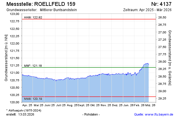
Current data ROELLFELD 159
Groundwater level [m above sealevel]: 120.88
Distance to surface [m]: 28.5
Last value from 24.06.2026 10:00
Ground level [m above sealevel]: 149.38
| Date | Groundwater level [m above sealevel] |
|---|---|
| 28.06.2026 | 120.80 |
| 27.06.2026 | 120.81 |
| 26.06.2026 | 120.82 |
| 25.06.2026 | 120.84 |
| 24.06.2026 | 120.85 |
| 23.06.2026 | 120.86 |
| 22.06.2026 | 120.87 |
| 21.06.2026 | 120.87 |