
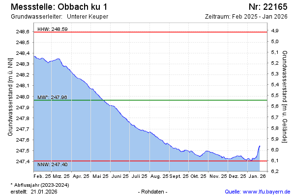
Current data Obbach Ku1
Groundwater level [m above sealevel]: 247.74
Distance to surface [m]: 5.77
Last value from 01.07.2026 09:00
Ground level [m above sealevel]: 253.51
| Date | Groundwater level [m above sealevel] |
|---|---|
| 30.06.2026 | 247.72 |
| 29.06.2026 | 247.72 |
| 28.06.2026 | 247.73 |
| 27.06.2026 | 247.74 |
| 26.06.2026 | 247.75 |
| 25.06.2026 | 247.75 |
| 24.06.2026 | 247.76 |
| 23.06.2026 | 247.77 |