
- Start >
- Groundwater >
- Waterlevel of upper layer >
- Unterer Main >
- Mühlfeld Mu11 >
- Chart of total period

Chart of total period Mühlfeld Mu11
Groundwater levels of the total period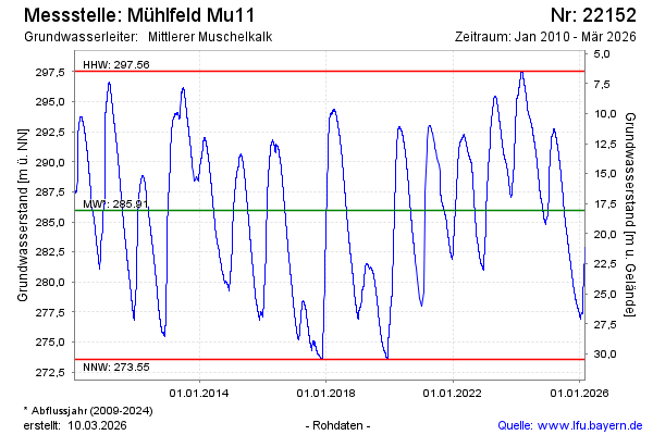
Groundwater level [m above sealevel]: 294.17
Distance to surface [m]: 9.85
Last value from 16.05.2024 10:00
Ground level [m above sealevel]: 304.02
| Date | Groundwater level [m above sealevel] |
|---|---|
| 16.05.2024 | 294.20 |
| 15.05.2024 | 294.22 |
| 14.05.2024 | 294.27 |
| 13.05.2024 | 294.32 |
| 12.05.2024 | 294.37 |
| 11.05.2024 | 294.43 |
| 10.05.2024 | 294.49 |
| 09.05.2024 | 294.55 |
© Bayerisches Landesamt für Umwelt 2024